| Elizabeth Bato | 2021-10-03 |

expert map | Team reviewed:
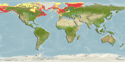
Added FAO areas 18, 61 and 67. Modified northern, western and eastern limits from 76°N, 120°E and 0°E to 90°N, 180°W and 61°E. Modified minimum and maximum depth from 9 and 240 m to 0 and 1267 m (Ref. 116516). Decreased minimum water temperature from -0.66°C to -5°C. Adjusted minimum salinity from... More
Modify | 151 |    |