Available maps for
Isurus oxyrinchus
:
Click on the map to proceed.
Close window
|
Search
|
See criteria for rating
Reviewer
Date Map Last Saved
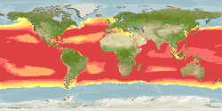
Map
Remark
Number of good cells available /
used for envelope calculation
Rating
Kathleen K. Reyes
2021-07-18
expert map
Team reviewed:
Adjusted maximum depth form 750m to 888m ( https://dx.doi.org/10.2305/IUCN.UK.2019-1.RLTS.T39341A2903170.en). Adjusted minimum SST from 2.7°C to...
More
Modify
3589
2020-05-12 00:00:00
default map
Computer Generated Native Distribution Map
3589